Winter hillwalking is a thrilling adventure that offers breathtaking landscapes blanketed in pristine snow. However, the season’s beauty comes with its own set of challenges and risks. As an intrepid winter hillwalker, it’s crucial to be prepared for the unexpected. In this guide, we’ll delve into essential emergency procedures to ensure your safety in the frosty wilderness.
Preparation is Key:
Before embarking on a winter hillwalking expedition, thorough preparation is non-negotiable. Equip yourself with the right gear, including insulated clothing, waterproof boots, gloves, and a reliable backpack. Carry an ice axe and crampons and know how to use them. Put the crampons on before you really need them so you aren’t teetering on an icy slope trying to put them on. Carry a map and compass, and consider using a GPS device to navigate in challenging conditions. An altimeter can also help. Many sports watches have this feature now. Inform someone trustworthy about your route and estimated return time. Pick someone who cares that you return!
Weather Awareness:
Winter weather can be unpredictable, and conditions can change rapidly. Keep a close eye on weather forecasts, MWIS and the Met office are particularly useful in the UK Pay attention to temperature drops, wind speed, and snowfall predictions. Familiarise yourself with the signs of impending storms and be prepared to alter your plans if necessary.
Navigation Skills:
In winter, landscapes can be obscured by snow, making navigation challenging. Brush up on your map and compass skills before heading out. OS Maps and OS locate are particularly useful Apps as is FatMap, if abroad. If you’re using a GPS device, make sure it’s fully charged and carry spare batteries. Always have a backup navigation plan in case technology fails. If you don’t know how to use a map and compass take a course and learn. Our NNAS courses are particularly useful.
Emergency Shelter:
Winter conditions can turn severe, making it essential to have a reliable emergency shelter. A lightweight, compact tent or a bivvy bag can provide crucial protection against the elements. Practice setting up your shelter before your trip, so you’re familiar with the process in challenging conditions.
First Aid Essentials:
Accidents can happen in any season, but the consequences can be more severe in winter. Pack a well-stocked first aid kit, including items for treating frostbite, hypothermia, and injuries. Familiarize yourself with basic first aid procedures and consider taking a wilderness first aid course for more in-depth knowledge.
Communication Devices:
Maintaining communication with the outside world is vital in case of emergencies. Carry a fully charged mobile phone with a backup power source. Additionally, consider investing in a personal locator beacon (PLB) or satellite messenger to alert rescue services if needed.
Group Dynamics:
If you’re hillwalking in a group, establish clear communication protocols and emergency signals. Keep an eye on each other, especially in challenging terrain, and have a plan in case someone gets separated from the group. A whistle can be an effective tool for signalling in low visibility conditions. Remember the International distress signal; 6 blasts of a whistle or flashes of a torch at 1 minute intervals. The reply is 3 blasts of a whistle or flashes of a torch. Make sure you don’t succumb to peer pressure. If you don’t like it, be prepared to turn back.
Know When to Turn Back:
A key aspect of winter hillwalking safety is recognizing when conditions become too challenging. Trust your instincts and be willing to abandon your plans if the weather takes a turn for the worse. It’s better to retreat and live to walk another day than risk unnecessary danger.
Conclusion:
Winter hillwalking offers unparalleled beauty and serenity, but it demands respect and careful preparation. By following these emergency procedures, you can ensure a safer and more enjoyable experience in the frosty wilderness. Remember, the key to a successful winter hillwalking adventure is a combination of knowledge, preparation, and a deep appreciation for the majestic winter landscape. Stay safe and enjoy your winter escapades responsibly.
Skiers and Boarders, you’ve conquered the groomed slopes, perfected your turns, and relished the rush of carving down meticulously maintained trails. But what if we told you there’s a whole new world of excitement waiting just beyond the boundaries of the resort? It’s time to break free from the confines of traditional snowsports and explore the uncharted territories of backcountry bliss. Backcountry skiing offers an exhilarating escape into untouched powder, breathtaking landscapes, and a sense of freedom that is unparalleled. So, are you ready to take your passion to the next level? Here’s why backcountry skiing should be your next thrilling adventure.
Unleash Your Adventurous Spirit:
Backcountry is the epitome of adventure. Imagine leaving the crowds behind, venturing into pristine wilderness, and feeling the crisp mountain air on your face. Backcountry offers a sense of freedom and exploration that is truly liberating. It’s a chance to escape the familiar and discover the untamed beauty of nature while enjoying the thrill of making fresh tracks in untouched snow.
Connect with Nature on a Deeper Level:
While ski resorts provide a fantastic experience, there’s something magical about immersing yourself in the unspoiled beauty of the backcountry. Surrounded by towering peaks, dense forests, and untouched snow, you’ll feel a profound connection with nature. Backcountry allows you to appreciate the serenity of the mountains and experience the raw, untouched landscapes that most Snowsport enthusiasts never get to see.
Escape the Crowds:
One of the greatest perks of backcountry skiing and boarding is the opportunity to escape the hustle and bustle of crowded resorts. Instead of waiting in line for lifts, you’ll be forging your own path through pristine powder. Backcountry offers solitude and tranquility, providing a refreshing break from the business of the ski resorts. It’s just you, your gear, and the vast expanse of untouched snow.
Elevate Your Skills:
Backcountry is not only an adventure for the soul but also an opportunity to hone and expand your skills. Navigating varied terrain, mastering uphill climbs, skinning and adapting to changing snow conditions will challenge you in new and exciting ways. Avalanche safety and safe route finding are skills to be learned and honed. As a skier or boarder transitioning to the backcountry will push you to become more versatile and confident in your discipline.
Embrace the Element of Discovery:
Every backcountry adventure is a journey into the unknown. With no groomed runs to follow, you’ll be forging your own path and discovering hidden gems along the way. The element of discovery is what makes backcountry snowsports a truly unique experience. Whether it’s finding a hidden powder stash or stumbling upon a breathtaking viewpoint, every trip into the backcountry is an opportunity for exploration and surprise.
Conclusion:
Skiers and Boarders, the backcountry is calling, and it’s time to answer. Embrace the wild, challenge your skills, and discover the unparalleled joy of sliding in the backcountry. Venture beyond the resort boundaries and unlock a world of untouched powder, breathtaking scenery, and pure, unbridled adventure. The backcountry is waiting – are you ready to make your mark on its snowy canvas?
We have a full programme of Backcountry Adventures lined up for this season. check out the Backcountry Scotland and the Backcountry abroad pages
The National Navigation Award Scheme is a 3 level Navigation scheme, Bronze Silver and Gold, taking people from a level where they can’t read a map or use a compass to being accomplished Navigators. At a time when these skills are at a premium amongst people going to the hills for the first time due to Covid, it’s a very useful addition to our products. We offer at the moment, Bronze and Silver Courses, we will be offering Gold courses in the near future.
Our Bronze courses are delivered over 2 days in Mugdock park and Carron Valley on the Campsies, with a journey and ascent of Meilkle Bin, the highest point on the Campsies on day 2. The bronze course teaches you to Navigate on paths and uses pacing and timing to achieve accuracy in both planning a trip and executing it. Our first few courses have been offered mainly to our existing clients in order that we could achieve realistic and meaningfull feedback on the products we were delivering.
Day 1 of the bronze begins with a socially distanced Coffee and an explanation of what the 2 days will entail and an explanation of maps and their different scales. We then move out into the park for a map setting exercise and a journey through the park using an orienteering map. Our candidates take a turn at navigating us along different legs of tthe journey. They are introduced to pacing and timing, contour lines, handrailing, collecting and catchment features ea ch skill is progressively introduced and built on the previous skill before we know it is 4 in the afternoon!
Day 2 is the assessment day. It’s continual assessment and working on the skills we learned the day before. We go on a journey summitting Meikle Bin. It’s a long walk working on pacing and timing and orientating the map. It’s amazing how much people’s skills improve as the day progresses and their skills increase! At the end of the day we have a debrief and tell people their results! After a happy ending people generally leave with a desire to learn more.
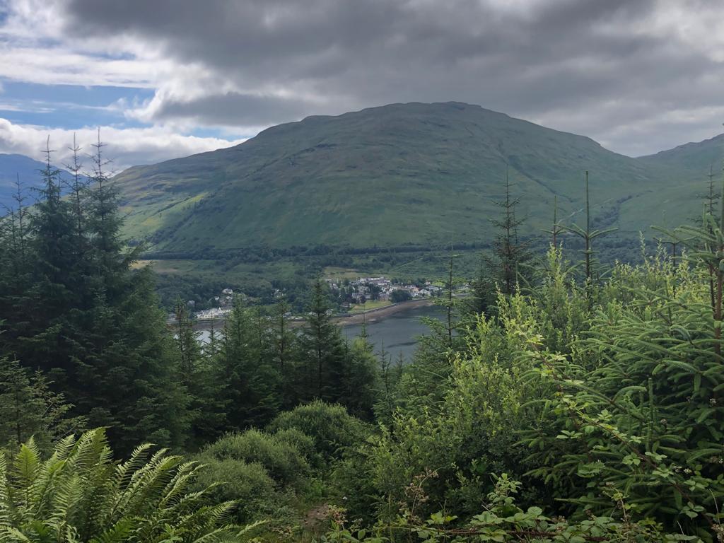
After our successfull bikepacking trip to the islands,we arranged another couple of excursions for our clients including Marjan and her son Shayan. Marjan had been let down by the cancellation of a 3 peaks challenge due to Covid. The suggestion: Come up to us for a couple of days walking and at least do Ben Nevis, preferably via the Carn mor Dearg Arrette and we will manage to fit in something else on the way up.
I picked up Marjan and her son at Glasgow Airport early on a Friday morning from a London flight and drove North towards Loch Lomond with the ultimate destination of Fort William. At Tarbet though, we turned left to Arrochar and met Bill and Shirley in the carpark of the Arrochar hotel, avoiding the daylight robbery of the local authority car park at the foot of our destination., The Cobbler or Ben Arthur. The local authority have recently increased the price of a days parking in this car park to £8. Nothing but a local tax on Hillwalkers.
Arrochar
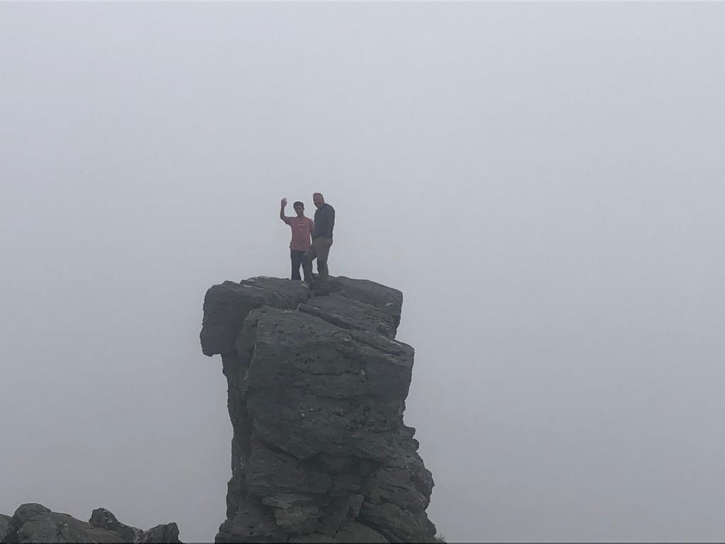
We walked uphill on a pleasant day if a little dull. it was however, warm and dry and a bit misty at the top. After a pleasant climb,there was nothing else for it but to thread the eye of the needle or go through Argyle’s looking glass. a hole in the rock leading to an exposed ledge and a short scramble to the top. It was a little misty but no wind It takes a little nerve and a head for heights but is a straight forward scramble.
Shayan and Kenny after threading the needle
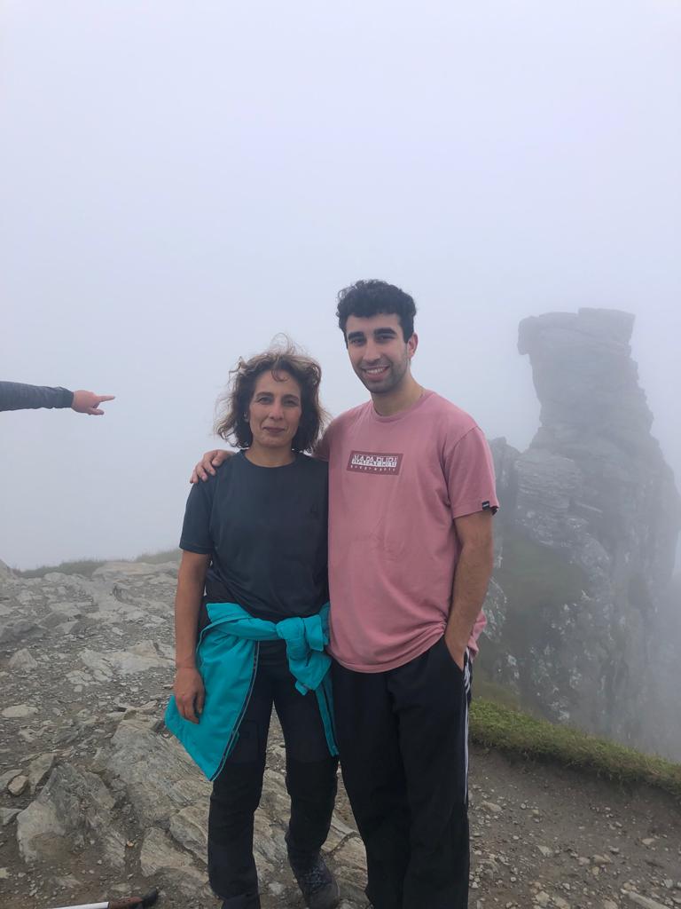
This is the highlight of the climb and well worth the effort. Marjan was watching us climb it with just a little trepidation! It’s fair to say she was a little relieved to see us come down from the spectacular position.
Marjan and Shayan
great climb and now for the descent, and the run up to Fort William and tomorrows expedition.
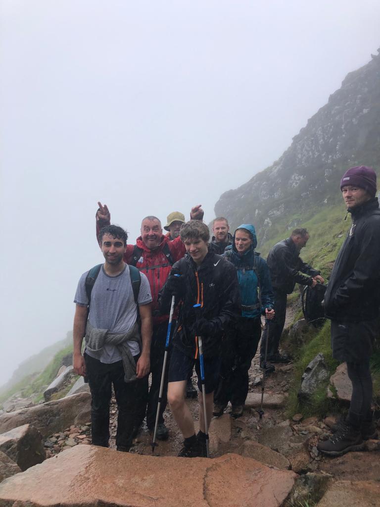
The forecast for Saturday was terrible with heavy rain all day. Various alternatives were considered including canyoning and a via ferratta at kinloch leven, Colin Donnie and Amy decided to take this alternative but Marjan and Shayan had flown up from London with the intention of climbing the Ben. While the Carn Mor Dearg Arrette route was out because of the weather, there was always the pony track and we would be getting wet anyway! It was decided. We were off. Dave, Dawn and Jack along with Andrena decided to join us. We were off…
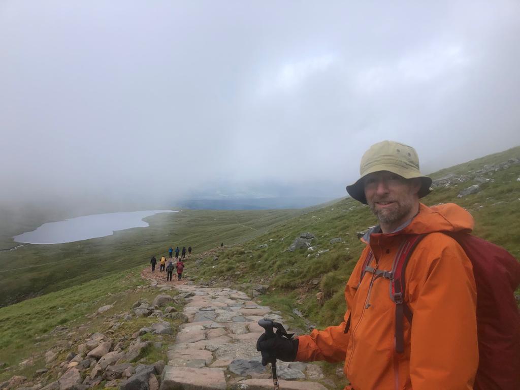
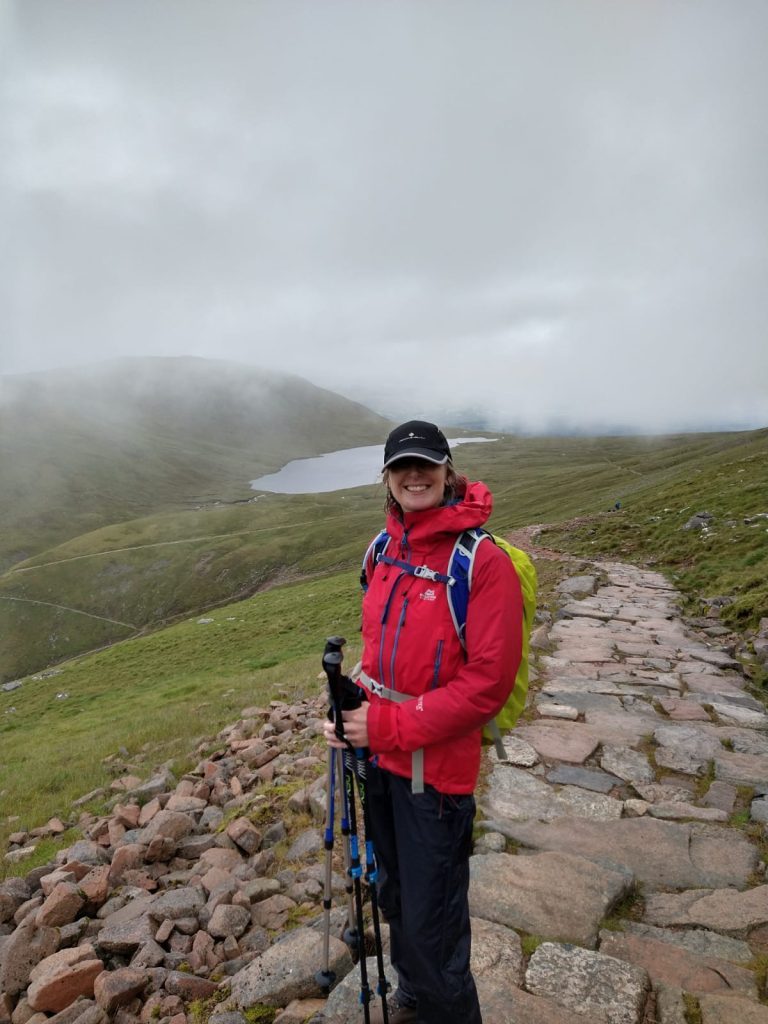
The approach to the Pony track from the Glen nevis visitor centre car park. The hill was shrouded in mist and drizzle fell constantly thoroughly wetting everyone. I was very greatfull for my Mountain Equipment waterproofs. Thankyou Mr Gore!
A long slow climb in the rain gave time to observe the other people on the track and the various standards of clothing worn, everything from shorts and T shirts and trainers, to city clothing and shoes. That was going to be interesting as they climbed higher and it got colder. There was snow on the top. Goodness knows what goes through peoples minds when they think about walking on this hill. Many drastically underestimate the seriousness of the expedition. By climbing the Ben, you are effectively going back a season due to the height, the temperature and the weather conditions. 99 times out of a hundred, under equipped people will get away wth it, but that odd time they won’t, putting at risk the lives of the professional rescuers and mountain rescue volunteers. People should be prepared for bad weather, the cold and with good boots. To say nothing of having a map and compass and knowing how to use them. Rant over!
At the redburn
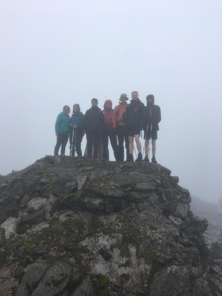
We carried on up the hill and into the cloud, eventualy hitting snow just before the summit. Cold wet and elated we arrived at the summit for the obligatory picture
Summit success. the highest point in the British Isles
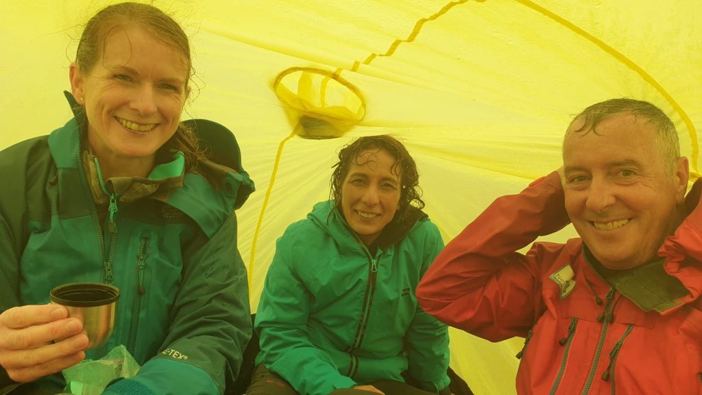
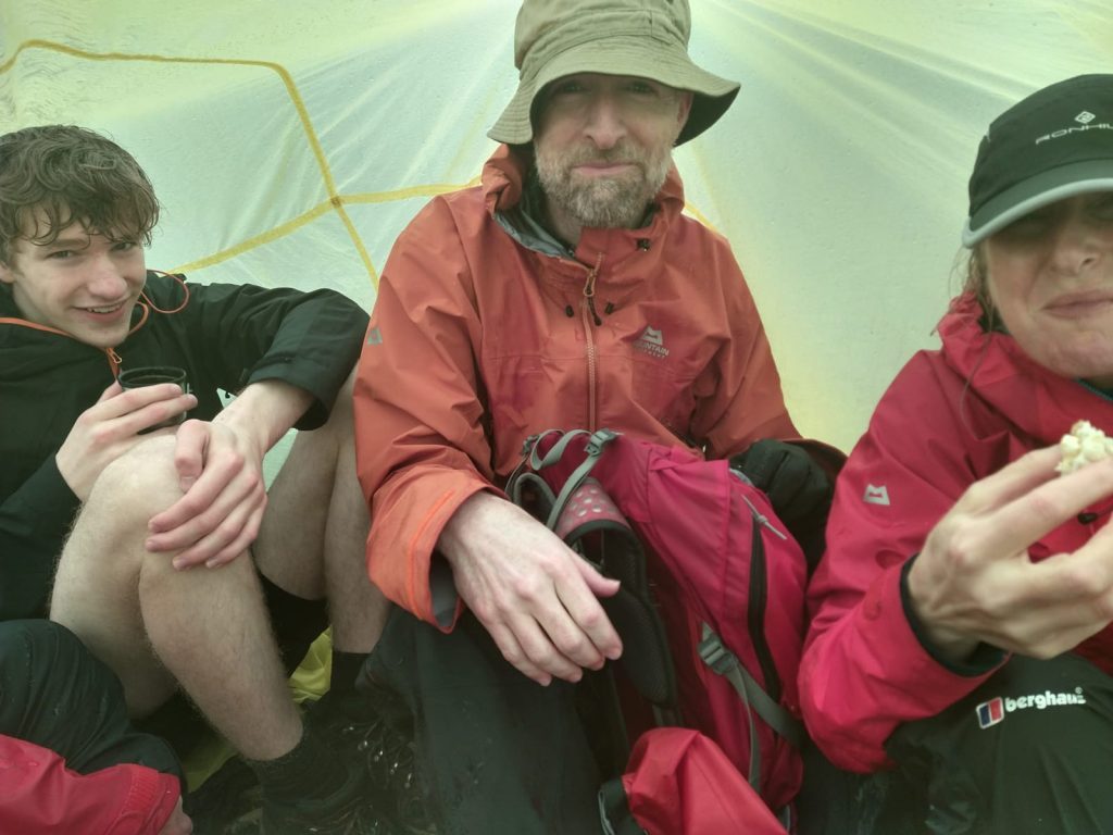
It was cold and damp when we finished time to break out the emergency shelter at least we would be dry eating our lunch!
Inside the emergency shelter. Hot soup, tea and sandwiches. Oh and a hipflask of 12year old thanks Dave!Emergency shelter. Great for a warm up!
On the way down things began to clear. Dave above the half way Lochan.
Dawn, on the way down
We arrived at the bottom 5 and half hours after starting. Bang on the book time. Straight into the Achallader bunk house for a well deserved Lager shandy and chips. Well done folks! We had a celebratory dinner that night in Fort William before heading South and for Marjan and Shayan the London flight. Another great trip.
Since Lockdown began many things have been on hold, we had to cancel lots of skiing, a planned trip to Iceland and a couple of trips to the Alps. Duke of Edinburgh Expeditions which were due to begin in April and run throughout the summer and autumn were all cancelled and are still not back to normal as was an expedition to Malawi. So after a long few months we decided that it was maybe time to give something back to our existing customers…
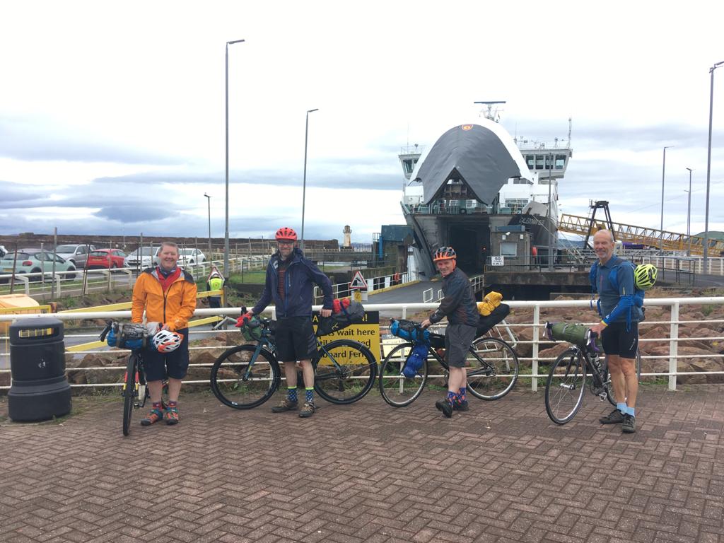
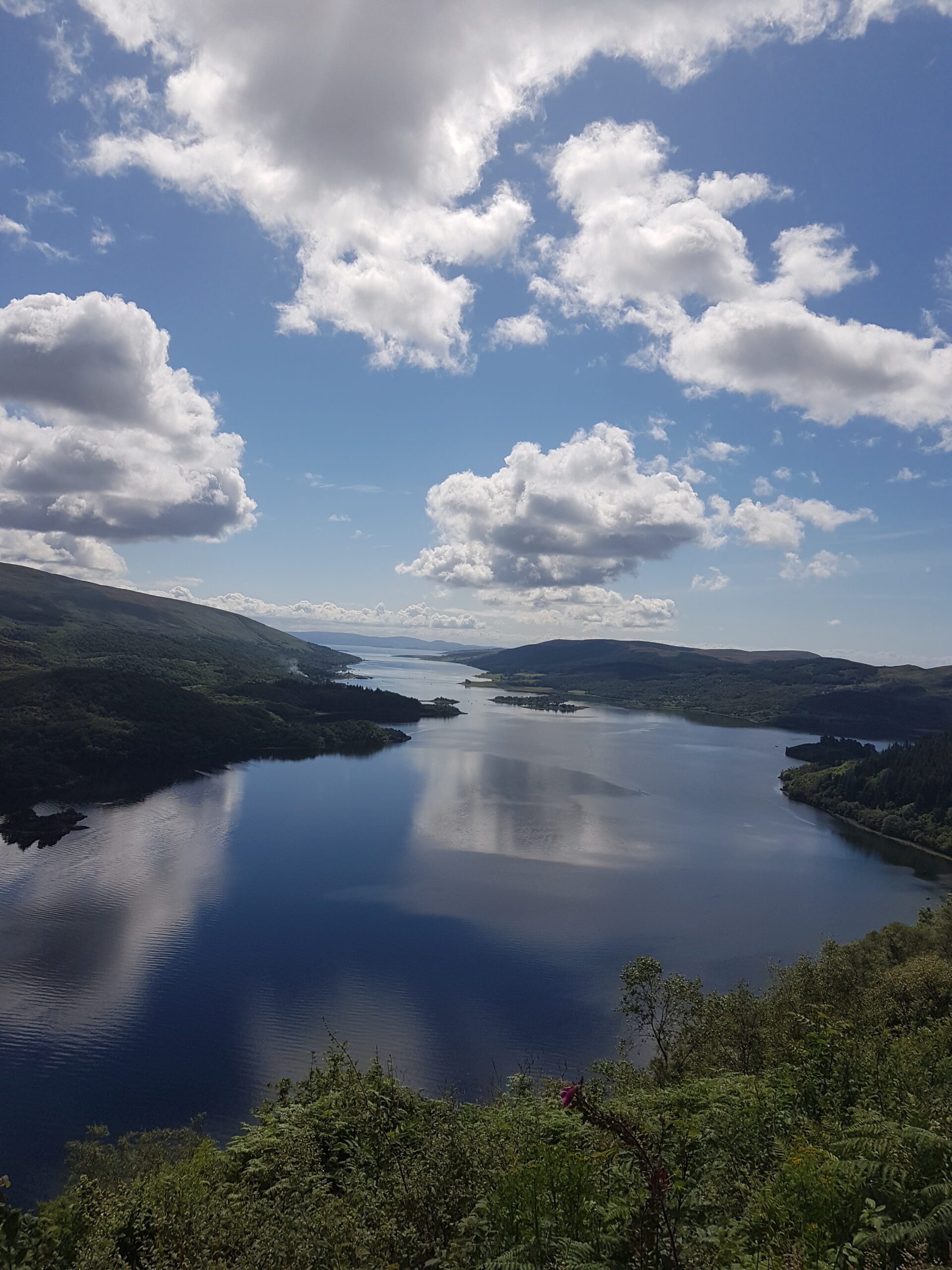
A bike packing trip was organised for some of our customers with a real sense of adventure. The trip was over 5 days and sampled some of the best the Inner Hebrides had to offer. Our route would take us from Ardrossan to Arran, to Kintyre, to Gigha, to Islay to Jura and back to the mainland and then to Bute and back to Wemyss bay. We would be wild camping and using camp sites that were open. The challenges of booking Caledonian Macbrayne ferries during Lockdown when they had minimal capacity should not be underestimated. Eventually the various bookings meshed together and the trip was on! Colin MacAllister proved himself a logistics wizard in the planning.
Departure for Arran on day1
Day 1 Ardrossan to Arran, a misty day, 7 intrepid cyclists on a mixture of road and gravel bikes crossed to Arran and cycled through Brodick in light drizzle heading North to Lochranza. The bikes were laden with a mixture of saddlebags, frame bags and handlebar bags each bike had about 20kg of kit , tents, sleeping mats, sleeping bags, cooking equipment, spare clothing and other gear. The pull from Sannox up the hill before the descent to Lochranza was “challenging” to say the least! Of the 7 cyclists 2 were experienced road cyclists, 3 very fit individuals, one fit lady plus me!
We cycled round to Lochranza and waited for the ferry at the little sandwich shop nearby. It had been a long time since breakfast and the Ham and Cheese Salad on Sourdough along with an Americano was very welcome! The ferry took us over to Claonaig and we began the long climb over the B8001 and a great scary descent to Redhouse at the junction to the A83 the main road to Campbeltown. We cycled down the main road to Tayinloan well spread out with the Road cyclists well to the front with me bringing up the rear!
Social distancing Cal Mac style
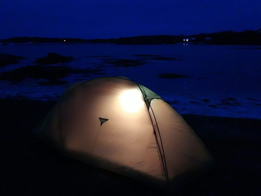
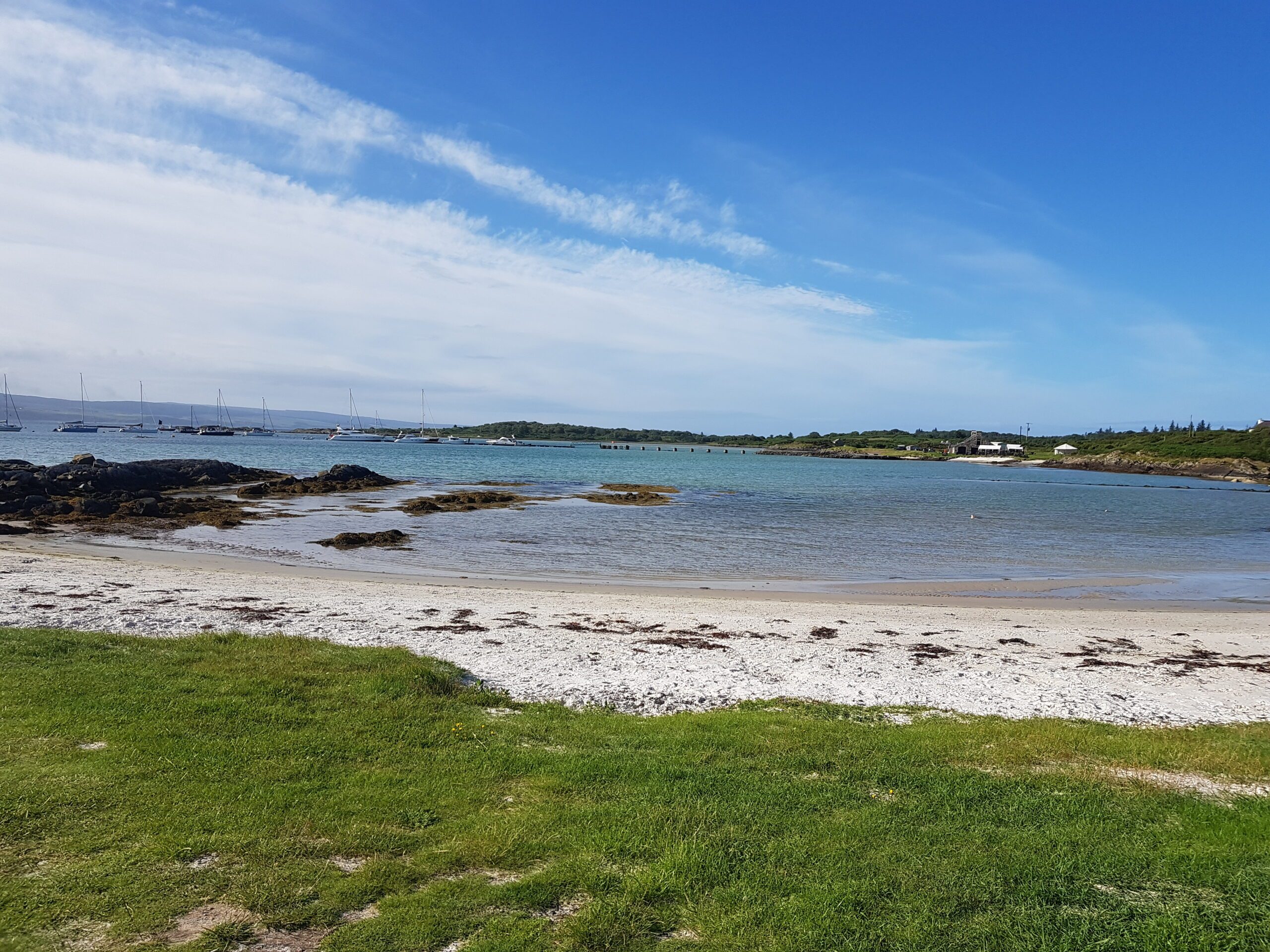
We arrived at Tayinloan and caught the ferry to Gigha arriving about 4pm. A quick scout to the local shop and we were informed that we could camp on the beach near the ferry terminal. Breakfast supplies bought, we set up camp on the beach on a pleasant evening looking out towards the mainland. We did try and book the one star Michelin restaurant but it was booked solid with yachtsmen. We were successful in booking the Gigha hotel and had our first draught beer and restaurant meal since lockdown and it was excellent
First night on Gigha
We headed back down to the shore and an early bed just after 10pm. We discovered the toilets at the slipway were open and the bonus point was that the fresh water tap at the side Coastguard station was working. Result!
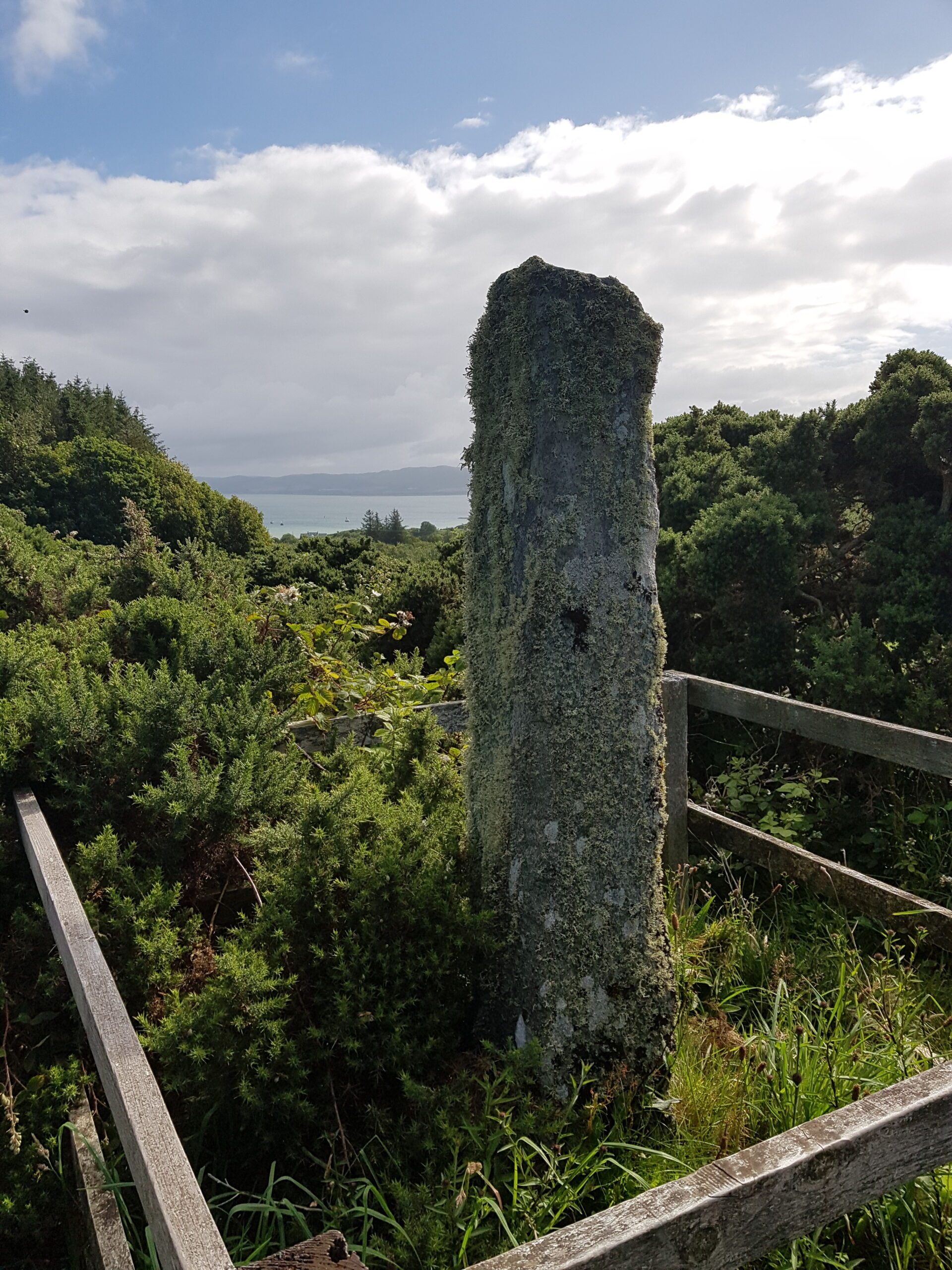
Day 2. The next morning we had time for a quick exploration of Gigha before catching the ferry back to Tayinloan We cycled to the North end and then up to the Oggam stone and the old cemetry.
Oggam stone
Ferry back to Tayinloan and then the road up to Kennacraig for the 3pm ferry to Islay. Only problem was that the ferry left at 1pm and not 3! Oops. Cal Mac booked us on the next ferry at 6pm and it’s a 2 hour crossing. Our campsite was at Port Charlotte, 24miles from the ferry port at Port Ellen! So we had to cool our heels until 6pm. 5 miles to Tarbet to stock up on supplies and visit a coffee shop. The late arrival on Islay meant that we wouldn’t get a restaurant or pub open until the next day Sunday…..! We ate the supplies we had bought in Tarbet on the ferry and debated what to do. The decision to be made was, do we camp near Port Ellen or go for it and cycle to Port Charlotte. We arrived at Port Ellen and decided to go for it.
We arrived at Port Ellen community campsite at 10pm, just as it was getting dark, having braved head winds, rain squalls, tired legs and sore backsides! The camp site is very modern and gets a big thumbs up. The showers were to die for, unlimited hot water. I didn’t want to come out! We tried for the pubs but all had closed at 10pm and tomorrow was the Sabbath….! Fortunately I had forseen some of this and the half bottle of grouse purchased earlier in Tarbet went down well between us as a night cap!
Day 3 The next morning we planned to go to Jura. The ferry port for Jura is at Port Askaig about 15 miles from Port Charlotte. As it was Sunday morning, we couldn’t get breakfast and made do with tea and porridge. The plan was to go to Port Askaig, get breakfast and the 12 mid day ferry to Jura. When we got to the Port Askaig hotel around 10, it was like the Marie Celeste. I eventualy found a cleaner who told me that the Hotel wouldnt open till 12! We kicked our heels for an hour and a half and eventually found the chef who agreed to do as a brunch in the hotel. A negotiation with the ferry master found our ferry postponed for 2 hours and a great lunch was had by all. We then took the ferry across the short crossing to Feolin on Jura. The Ferry Master warned us to be back by 4.30 if we didnt want to spend the night on the island. As the hotel on Jura was still closed and all our camping kit was still at Port Charlotte, we agreed! We then began the cycle along the shore and the steep ascent into Jura along mile after mile of quiet road. We used time to judge when to return and after an hour decided to turn back. After a thrilling descent we returned along the shore and could see the ferry leaving Port Askaig to meet us. As soon as we were on the ramp it started to rise up and the ferry moved off. We were told the crew were “on a flier”! After the steep climb out of Port Askaig we made the 15 miles back to Port Charlotte with ease and with the wind behind us. Dinner that night was in the Port Carlotte Hotel and was excellent.
After a few beers we returned to the campsite and another early night.
Day4 We Packed up early and had breakfast in the Cafe in the camp site which can be recommended! We then began the cycle to the only distillery with a tour that was open Kilhoman. a cycle again of about 15 miles to the distillery which is unique in that it produces all its whisky from barley, peat and water on Islay. We had a very interesting tour of the distillery and made the cycle back to port Charlotte for the ferry to the mainland. Another small logistical problem arose in that we had approximately 45 mins to get to Tarbet for the last ferry to Portavadie in order to get to our final campsite at Kames. Unfortunately despite us asking the crew if we could get off the ferry first at Kennacraig we were kept till last! Well done Cal Mac!This cost us more than 15minutes and put us immediately under the cosh to make the 5 hilly miles to Tarbet in less than 30minutes. No mean feat with heavily laden bikes. The road cyclists managed with ease, we turned the corner at the end ofTarbet and got on the ferry with seconds to spare! No pressure!
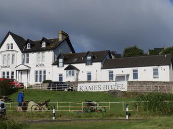
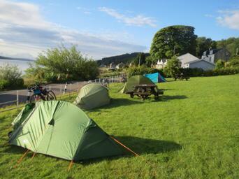
After what we had done already that day the cycle to Kames was fairly smooth. Colin had organised that we could camp in the paddock in front of the Kames Hotel which is essentially an extension of their beer garden! It’s a stunning location with views over the Kyles of bute. Initially the Hotel manager denied knowledge until shown the email. on Colin’s phone and told we had a booking for dinner! She changed attitude and told us to “fill our boots” In fairness she was under pressure and had few staff. we had a great night in the hotel and slept well in the beer garden, another first.
Kames Hotel
B eer Garden Camp site
Day 5 The next day dawned bright an beautiful in a stunning location. We had breakfast in the hotel and headed for the big climb out of Tighnabruaich. The climb, which seems never ending finishes at a spectacular viewpoint looking down the Kyles of Bute. Spent a few minutes there catching my breath and admiring the view which I think is probably one of the best in the countryA great descent down to Ormidale then followed the A road to Colintraive with more climbs en route.
The crossing from Colintraive to Bute is the shortest ferry crossing in Scotland it only takes a few minutes to get to Bute and the relatively flat coast road to Rothesay. On Arrival at Rothesay we treated ourselves to a well earned Nardini’s ice cream! and the ferry back to Wemys bay. There the team split with 4 taking the train back to Glasgow and the remainder cycling back along the coast road to Ardrossan. This was the only time during the trip we were exposed to heavy traffic and in sections it wasnt pleasant particularly going through Largs and passing Hunterston where very little distance was given by passing drivers. A culture shock afer 5 days of island tranquility. So ended a fabulous trip. Would I do it again? in a heartbeat. The scenery in the islands is fantastic and for me, so close to home. The clients loved it too. It’s also something I will consider organising for the business in the future. Bike packing. its the way forward:}
Lockdown has been interesting! With all bookings halted for a 3 months period and a complete disruption of all our summer activities and Duke of Edinburgh Expeditions It has been a surreal period. I was notified a few weeks ago that my web hosting company, Mr Site was going out of business and my web sites were being switched off from the 30th of June! This concentrated the mind somewhat and has resulted in this spanky new web site being developed. The web sites were badly needing upgraded, which I have now done. It should now be much easier to update information.
Lockdown has provided an interesting period of reflection on where we would like Nevis4 to go in the future. The answer to that is that we will concentrate on the areas we are passionate about. Hillwalking, Skiing, Navigation and Cycling and the important DofE expeditions, something we regard as being very important in young people’s development.
I have been fascinated with investigating local history during Lockdown as many people have, with everything from Iron age forts to cold war Royal observer corps bunkers all, on my door step. I realise I have been very fortunate living where I do. I have spent lots of time fascinated by the area, pouring over old maps and texts.
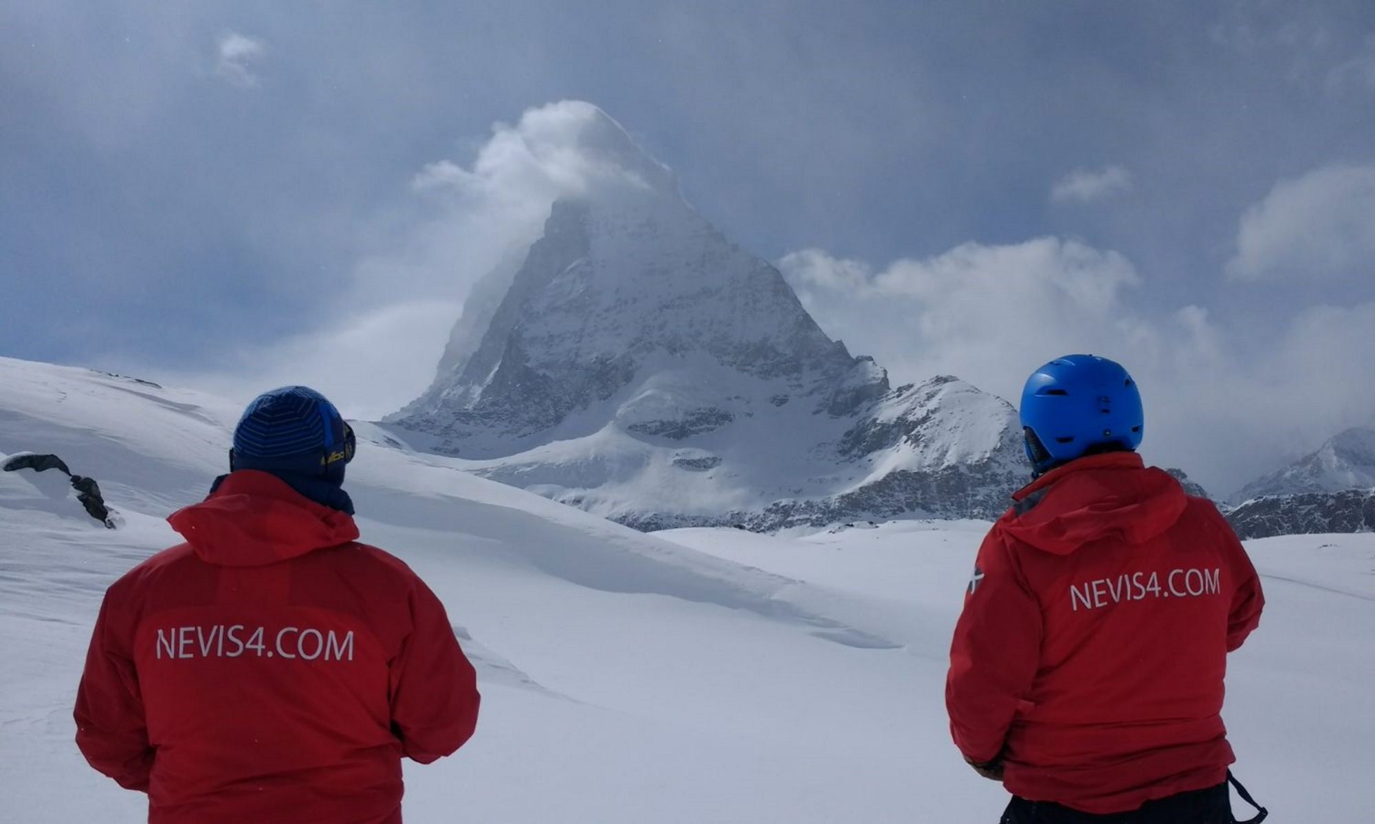
Ongoing work, apart from fitness, has included planning our trips to Champoluc in January, a programme on home snow in February and March and Iceland in April.
We also have a calendar of dates for open DofE expeditions going forward. All dates will of course, depend on moving from phase 2 through phase 3 and beyond. If you are new to our business, please have a look at the site and a look at what we do. If you are an old friend, check us out. We are absolutely passionate about our activities and we hope you will be too!
Nevis Extreme
The story below was written in 1995 and was the day that Nevis4 was born.
Its been there for a couple of seasons now, deep in the sub conscious whispering away at me. Whats the ultimate ski challenge, whats the steepest, highest slope I could ski in this country. The answer was obvious, Nevis. The Ben. Could I do it ? I have been into Extreme skiing for a few years now and had gradualy worked my way up steeper and steeper couloirs and headwalls but Nevis was the daddy of them all.
The name Ben Nevis translates literaly to “the venomous one”. Its Northern cliffs provide all different levels of ice climbing in winter from grade I to V they are the scene of numerous climbing deaths each winter, brought to our screens by a media thirsty for the scent of fresh blood. These cliffs are also the site of the steepest and longest couloirs in the scottish mountains. In theory virtualy all of the gullies on the North East face of Nevis could be skied given the correct conditions and in practice most of them have. That in no way detracted from the seriousness of the undertaking I contemplated. In late April this year the Avalanche reports settled down from a season which had been dominated by high risk reports to a period of low risk and settled weather. (Nevis gullies are no where to be in high risk avalanche conditions). If I was going to do it it had to be within the next few weeks before the best of the snows had gone or I forgot it for another year.
Life’s too short. I got on the phone and started making arrangements with the people I knew were mad enough to attempt the descent. Donnie Morris and Colin McAllister both long time skiing buddies leapt at the chance. Colin suggested Alistair Muir an ice climber and skier whose knowledge of the mountain could prove very usefull On the 30 April we set off on a warm spring morning from Achintee at about 1030 dressed in light clothing, T shirts, Tracksters and walking boots. The goretex jackets, pants and gloves we would need later in the ascent were stowed in our rucksacks along with our Alpine ski boots. Our skis were strapped to the side of our rucksacks and bound together at the tips to prevent them swaying around, also very evident were the ice axes prominently displayed on the outside of the sacks. They would prove invaluable later. Also with us, just for the walk were Linda McGhee, Alistairs brother and sisters and Ian McDonald from Lochaber Mountain rescue, a guy whose expertise we hoped we wouldnt need!
We began the climb in balmy spring weather and were soon sweating profusely under the weights on our backs, another hazard of the day was the number of people ascending and descending the mountain. Operation Raleigh was running the 3 peaks challenge – climbing the 3 highest peaks in the 3 countries, Nevis, Snowdon and Scafell Pike. We had picked one of the days chosen by Raleigh, all 600 of them! Given the fact that at the lower levels there wasnt a flake of snow to be seen, our very obvious burdens made us subject to many comments ranging from the mild ” Oh going skiing then ” to the infuriating “couldnt you have taken the lifts like everybody else?” Our replies became funnier and more ribald with every passing would be commediene.
The long slog up the tourist path was enlivened by Ian McDonald with his grisly tales of rescues and body recoveries from the Ben. He is also a fund of local knowledge about the mountain and its environs. A gradual change in the weather came about the two and a half thousand feet point. It became cloudy and began to rain lightly. The higher we got the colder it became. Suddenly it was no longer spring but very definetly still winter, the mountain was giving us a warning. The rain became heavier and changed to sleet, necessitating a stop to don jackets gloves and overtrousers. We reached the snow line and continued upwards the walking now much harder as the wet spring snow sucked at my light walking boots. We carried on upwards and soon arrived on the plateau to be awarded glimpses of the stunning cliffs and awesome cornices of this the highest mountain in these islands revealed through the scudding clouds. We carried on to the trig point at the top in time to view a sorry little tableaux unfolding within the emergency shelter. Three young children were crying with cold and exhaustion trying to regain some heat while eating their lunch. The adults responsible were milling around outside. Rescue team members who were manning the shelter as a control point for Raleigh were tending to them. As a team member so aptly put it “Let them risk their own lives if they wish but not the kids”.
A hurried lunch in the shelter of the cairn and suddenly it was show time. Apprehensively we donned our heavy duty Alpine kit, Salomon, K2, Dynastar, time to see if the adds were right. As soon as I heard the double click of my bindings I felt instantly more comfortable, switch to ski mode and a fast run of short radius turns down the summit plateau heading for the red burn as a warm up.
The term plateau is misleading, the summit is actualy an excellent slope to ski with wide snow fields. Just take care you dont stray too far to the North or you will fall off the edge of the world. As we skied ever closer to the Northern edge of the cliffs we looked for the gullies we knew were skiable from previous recorded descents. Our target was number 4 gully, a grade 1 ice climb and “escape route” for climbers in bad weather from the top of the ben. We located the gully and stopped to take a look, the breath caught in my throat. Donnie spoke first. “My god ! Theres no way we can ski that its huge” I looked down and was immediately inclined to agree. The gully was about 50 feet wide at the top narrowing between sheer rock cliffs into a funnel about 12 feet wide some 200 feet below. Beneath that the rock walls contined for about another 800 feet before opening into Coire na Ciste far far below – and steep! The impression was of a lift shaft in the shape of a funnel about 70 degrees on the scarp wall directly below the cornice. Further down the gradient eased to between 50 and 40 degrees. The cornice was massive, a monster that hung over the abyss. How to get in was the problem. None of us wanted to jump into space with the rock walls on either side waiting to punish any mistake.
This was getting very serious, one mistake here and my wife would be one very wealthy lady. Would the cornice stand the weight of a skier? Or would it break, sending the poor unfortunate crashing and tumbling down in a mass of broken snow, limbs and equipment towards the rocks far below. I wrestled with the problem trying to supress the fear which was growing in me like an animal. Across to the left the edge of the cornice was broken where a climber had exited from the gully and a small platform could be seen about 5 feet below the lip. Suddenly the solution was clear, the technical problems solved. Use ice axes, climb down to the platform and put the skis on there, no need for spectacular and dangerous heroics. Ian McDonald came into his own, hanging over the edge with his ice axe cutting and chopping away at the snow to enlarge the entry point, then strategically placing an axe buried up to its head so we could hang from the strap as we climbed over the edge. Who was to be first to go ? I took a deep breath and found myself saying”my idea I better go first”. I climbed over the lip and down to the platform, carefully digging the pick of my axe into the snow for a little security. My skis and poles were handed down to me one at a time, my K2 extremes suddenly seemed very flimsy and very narrow. I stepped carefully back into my bindings and stowed my ice axe down between the straps of my rucksack and the small of my back. Some wise guy shouted “I hope you know how to use that!” I smiled back up to them weakly my mouth to dry to retort. The prospect of arresting a fall in this situation didnt thrill me, it was likely to be terminal. The only way to go now was down, I was comitted. I stared at the curving snow wall of the gully some 50 feet ahead where I was to make my first turn.. A few deep breaths to ease the tension and slide. In a millisecond I crossed the gully and instinctively began to sideslip, fear of the snow quality and the presence of ice danced in my mind. Donnie roared “Turn Kenny turn!”. A positive pole plant and an explosive unweight and I was round, first turn made! This was easy. This was fun ! I stopped and watched Donnie drop in the tension all but gone. I took some photos I wanted this descent to last. Next up was Alistair he had obviously decided to make the descent he had been very unsure at the top. I could see he was psyching himself up. Suddenly he was moving and sitting back .I found myself screaming the Ski instructors Mantra ” Forward!” He was lost from sight above me behind a rock buttress but I could just see he had lost a ski and was replacing it. I became nervous again this was not the place for marginal skiing. Last to drop in was Colin, a couple of nice jump turns then wham,he collided with Alistair in a tangle of arms and legs and gales of nervous laughter. Mercifully they were still behind the rock buttress which saved them from the long slide.
We were all in safely and I renewed my descent, turn, turn, turn, down , down between the rock walls the soft spring snow was a pleasure. I found myself giving whoops of joy. It was a fabulous place. After what seemed like an eternity I burst out from the confines of the couloir to find myself high in an open air cathedral with huge rock walls towering above me. The sheer scale of Coire na Ciste (Coire of the coffin ) is breathtaking. I opened up carving long radius turns and swooped down the Coire now in bright sunshine the adrenaline still surging through me. We skidded to a stop about two thirds the way down the gully to take a few photographs and admire our surroundings.Words seemed inadequate to describe the beauty and desolation of the place it was Awesome. High above me I could see places I recognised from photographs and written descriptions, routes pioneered by the fathers of modern mountaineering. Tower ridge, The curtain, No 5 gully to name but a few.
Far below lay the Charles Ingles Clark memorial hut and the start of the long walk home. We slowly traversed the Coire taking in our surroundings and positioning ourselves for the best line down to the bottom of the Coire. As we pssed the exit from No 5 gully we could see, high in the couloir 3 other skiers doing it the hard way. Skis hefted on their shoulders they were slowly climbing to the cornice far above. We felt an instant affinity with them and shouted our greetings. They answered with a wave of a hand. The last section of the Coire was skied far too quickly in a flurry of short radius turns that hungrily ate up the altitude that had been gained with so much effort. We stopped when we ran out of snow just above the CIC hut and turned again to take in what we had accomplished. The completion of a hard won objective. Self satisfaction beamed from our faces now beggining to lightly burn from the spring sunshine. With much congratulations we packed our gear and set off down the Altt a, Mhuilinn before heading West under the towering Cliffs for Lochan Meall-anst-Suidhe and the tourist path back to Achintee. The end of a long exciting and tiring day, a fitting end to a marvelous season
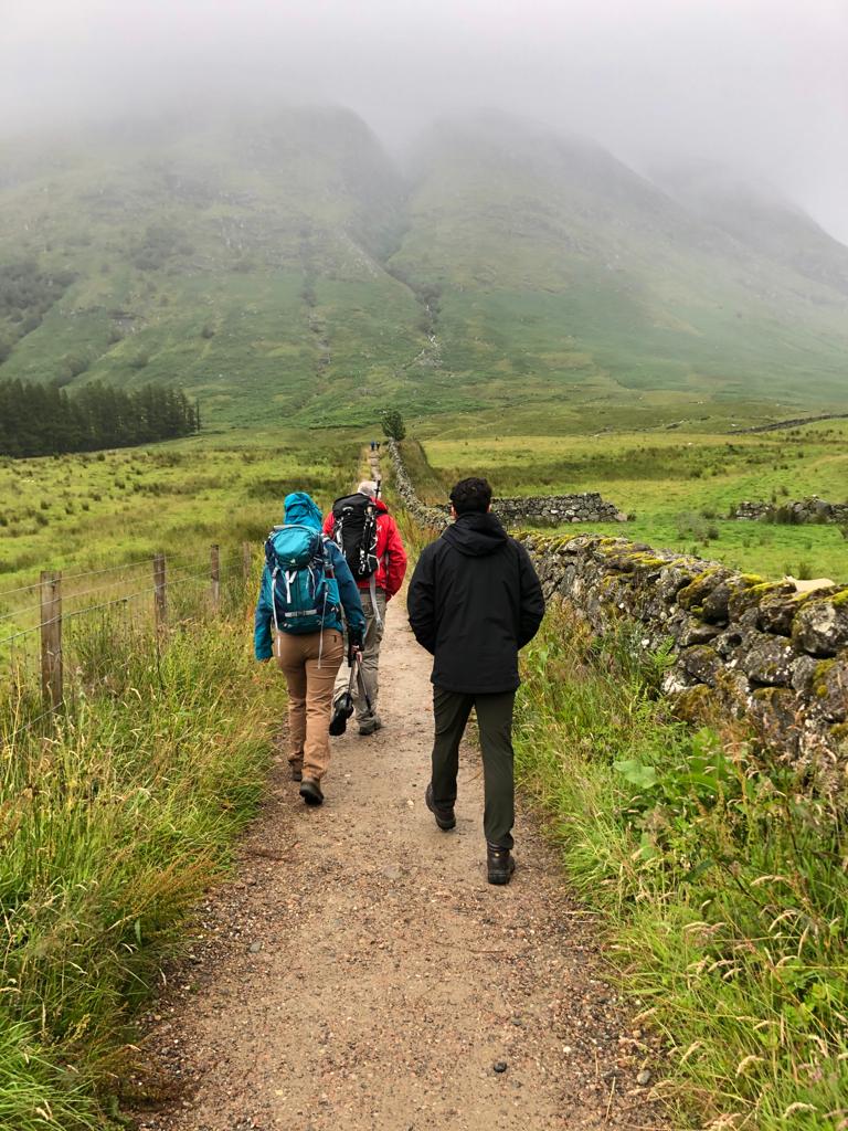 The approach to the Pony track from the Glen nevis visitor centre car park. The hill was shrouded in mist and drizzle fell constantly thoroughly wetting everyone. I was very greatfull for my Mountain Equipment waterproofs. Thankyou Mr Gore!